There are picture-perfect omusubi-shaped mountains in Kagawa!

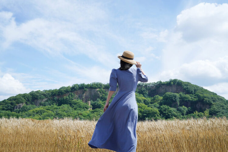
Our image of Kagawa is vast plains dotted with cone-shaped mountains.
The cores of the mountains are hard andesite pushed toward the surface of the Earth by volcanic activity 14 million years ago. The granite on the surface was eroded by the weather, resulted in cone shapes that resemble omusubi, traditional Japanese rice balls.
They are affectionally called Omusubiyama in Kagawa because they are as adorable as the pictures drawn by Mr. Shoji Ikehara, an artist born in Takamatsu, Kagawa who creates art for Manga Nippon Mukashi Banashi, renowned for its animation.
The elevation of these mountains is only 100 to 300 meters, so they are easy to climb. For this reason, they are popular among beginners and tourists.
Explore the nature and ruins of Mt. Yurayama

It is about a 30-minutes car ride to Mt. Yurayama from downtown Takamatsu. Mt. Yurayama's elevation is only 120 meters; therefore, it is suitable for children and beginners with little hiking experience.
Visit Mt. Yurayama, where you can view the scenery the locals love.

Mr. Shotaro Yokoyama, who works as a guide in the forests in and around Mannocho, Kagawa, accompanied us. He also shared with us a beginners' guide to hiking.


First, we stopped at Shimizu Shrine at the foot of Mt. Yurayama.

A green tunnel welcomed us at the trailhead. We departed along the east trail, which starts at the shrine.

The trail was steep in some areas, but the stone steps gave us solid ground to walk on.

88 miniature stone Buddha statues stood on both sides of the east trail in the style of the Shikoku Henro Pilgrimage, watching over us as we hiked.
After a while, Mr. Yokoyama asked us to touch the trunk of one tree.

"The trunk appeared rough, but it was actually springy to the touch, much like a cushion.
It was a Chinese cork oak, which has a thick cork layer under the outer bark. During the war, people used it as an alternative to cork."

In autumn, the tree produces acorns that appear similar to a sawtooth oak's.

When you observe Chinese cork oaks in the mountains, you will notice that some are tall and fully exposed to sunlight, while others are short and grow in shady places. We learned that the height difference is key to maintaining the health of the forest.


Further along the trail, we saw some China root. In Western Japan, China root leaves are used to wrap kashiwa mochi.
Underneath the round leaves of this vigorous climbing plant, there are thorns and vines that twine around tree branches to reach the sun.


We spent time enjoying nature and after 30 minutes, we reached the top.
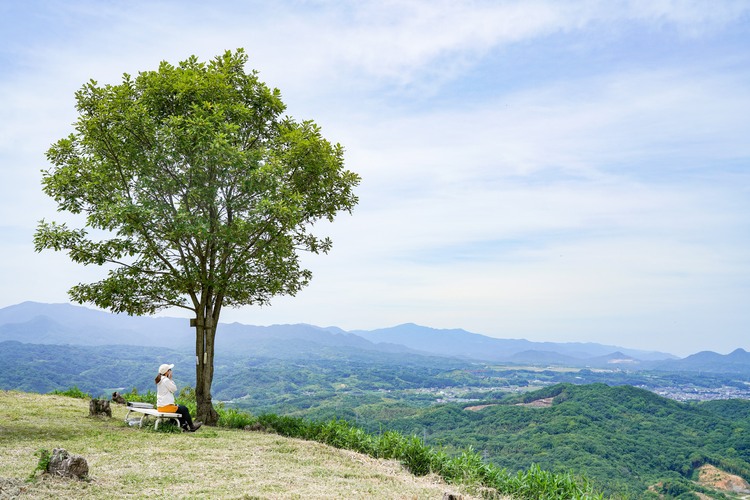
The 180 degree panoramic view of the Sanuki plain at the foot of the mountain and the Seto Inland Sea was wonderful. We enjoyed the view of the Yashima plateau in front of us, Mt. Gokenyama on the right, and Megijima and Ogijima on the left.
We had fun identifying the mountains and islands on the tourist information board.


The fine view quickly dispelled our tiredness.
After a break, we descended along the west trail.


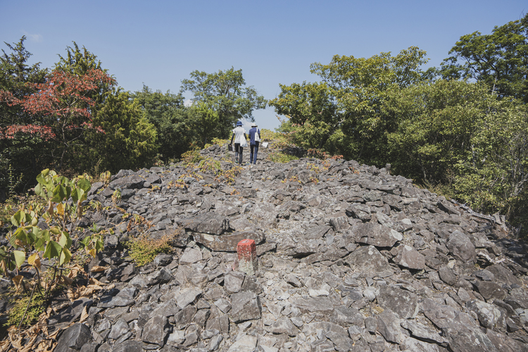
Suddenly, overhanging bare rocks came into sight.

We learned that the place was once a Yura stone quarry. The characteristic appearance - its columnar joint - suggests that the lava from volcanic activity that eventually became Yura stone contracted and cracked as it cooled and hardened.


Mt. Yurayama is made up primarily of medium-hard rocks that are biotite dacites. They are easy to carve and have been used to make tombstones and stone lanterns since the Edo period.
There is a wash-basin made of Yura stone on the grounds of Shimizu Shrine, which bears the inscription, "The second year of the Genbun era," which was 1737.


People across Japan learned about Yura stones when they were chosen to be the flagstones used in The Imperial Palace East Gardens in 1966. (They are no longer used in the garden.)
We enjoyed learning about the history of Mt. Yurayama during the short hike, and we shortly found ourselves back at Shimizu Shrine at the foot of the mountain.
"Beginners with little hiking experience, children and people who are uncertain of their physical strength can hike the Omusubiyama without worry.
Why not explore the nature of the Omusubiyama, which are unique to Kagawa, and be refreshed?"
Omusubiyama hiking
Pay attention to the flowers on the ground.

Pink woodsorrel

Small-leaf spiderwort

Brazilian vervain

Tufted vetch

Marlberry
Things to be careful when hiking low mountains:
- Wear a long-sleeved shirt, full-length trousers and sneakers. Wear light colored clothing to deter mosquitoes and bees. Avoid black clothing.
- If you encounter a hornet, avoid brushing it off with a hand. Instead, wait patiently until it is gone. Take extra care in autumn because hornets are more active in this season.
- Use insect repellant to deter mosquitoes and ticks. Check the ingredients of repellants carefully if you use them on children.
Hiking destinations in Takamatsu suitable for beginners:
Mt. Mutsumeyama (also known as Mimaya Fuji)
Altitude 317m
Mt. Mutsumeyama, Mt. Garanyama and Mt. Hazakoyama are often called the three Omusubiyama brothers.
Mt. Hiyama
Altitude 192m
The rural landscape including Saburo ike at the mountain's foot is really charming.
Mt. Doyama
Altitude 304m
You can admire the spectacular view of the city of Takamatsu from the viewing platform 274 meters above sea level.
Please also see the Kagawa Prefecture hiking website.
▼Easy hiking in the Udon prefecture
https://www.my-kagawa.jp/feature/mount/top
Mt.Yurayama
- Address
- Yuracho, Takamatsu, Kagawa
It is about 40 minutes on the Kotoden Bus (either the Kawashima line or the Nishiueta line) from Takamatsu Station to the Yura bus stop. The trailhead is a five-minute walk from the bus stop.
Parking: Hikers may use the parking lot at Shimizu Shrine. (The lot can accommodate up to eight cars.)
Gathering date:2021.8.2 / Mt.Yurayama


